notes by Huiying Ng
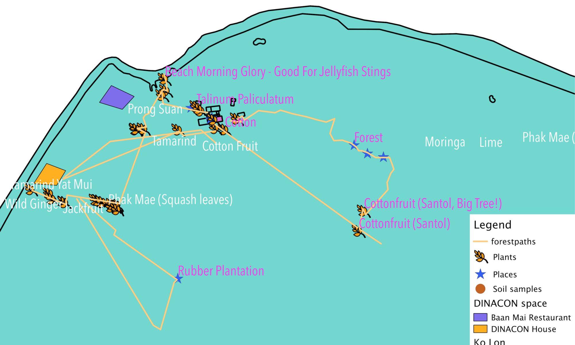
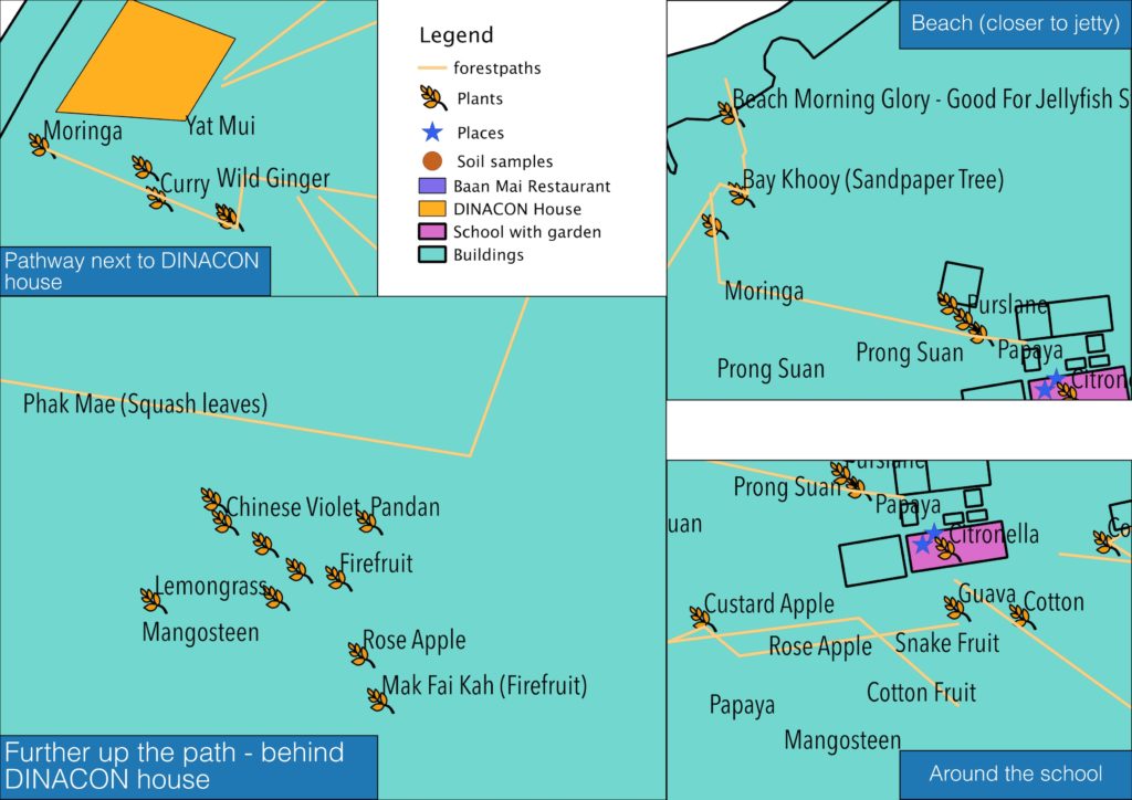
building on Craig Durkin’s foraging map
Some old/fossilied DINAsaurs are compiling a cookbook! Not just any cookbook; one with a guide to forageable ingredients and how they scatter over space.
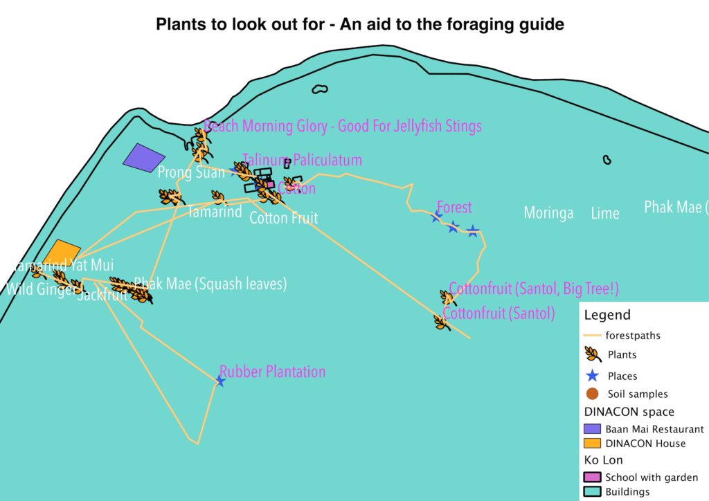
Why visualise plant scatter? Maybe because plant proximities intrigue us, or we’re seeking insect friends in nice ecological habitats, or a specific murky mud-water mix for a salty nightcap. Working through plants to find these other things has a zoom-out effect: seeing individuals in interconnected spaces.
But isn’t it also amazing how rife with life small patches are? And how much more we can learn to see?
More scatter(d) musings coming up. For now, we also consider:
- use and property relations: who “owns” the plants? How can we use them knowing that others in the forest also use them ? How do we create objects or extension tools to sense what stuff belongs to others? Fun maps aside, a map is great to plot out things in space, but use relations shift constantly. Sometimes the best maps are still in our heads!
- If maps are still a good viral way to spread ecological awe, what other functions could we place on the map? Categories of usability? Animal habitats? Shades of green? Land elevation?
- I am interested in how we image and imagine continuities of space, as an abstracted aspect of life. Life is spatial in so many ways we intuitively get. So messing around with space/sight means messing around with ourselves!
- Here are resources and ideas I’m/we’re continuing to work on with others, and resources you are free to build on and share-alike:
Soil tests: soon!
Raw files of geospatial data, available here.